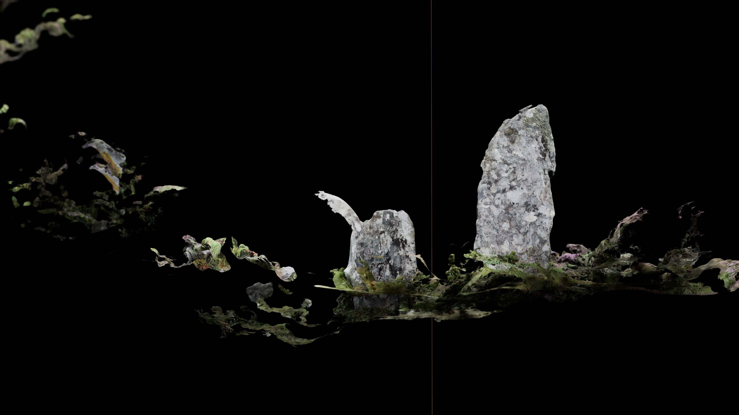
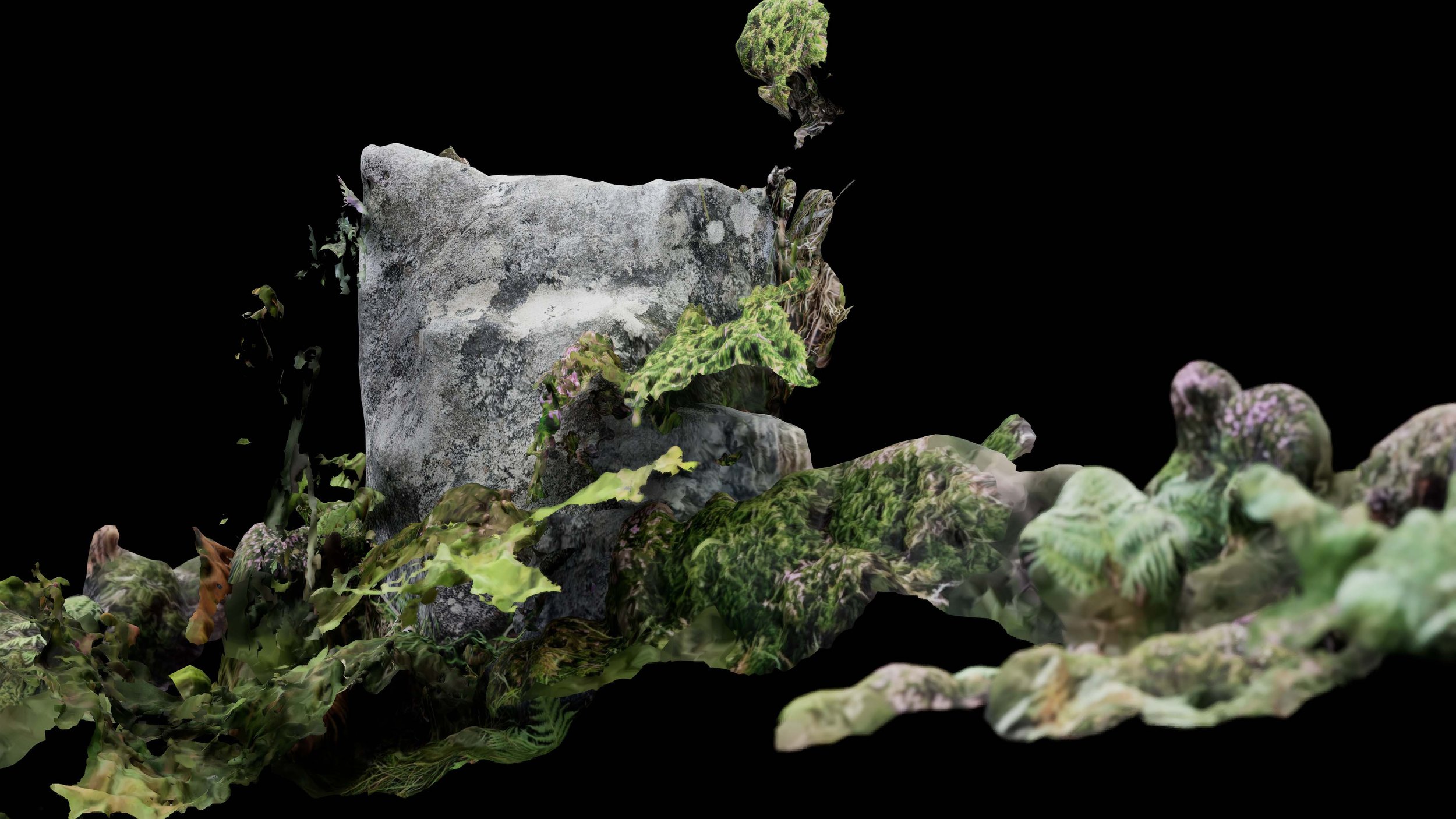
Lithic Orbit (2023)
(Lidar scan, customised software, desktop computer)
90 minute real time loop, 4096 x 1716.
Walking around the perimeter of a neolithic stone circle on North Uist, a remote Scottish island and proposed site for a new satellite launch facility, a lidar scan captured the rocks and vegetation within a single 3D scan. Using game engine software, the digitised historical site is augmented with simulated vegetation native to the area and slowly rotated over a 90 minute period – in synchronisation with the average duration required by Low Earth Orbit (LEO) satellites to orbit the planet. Virtual cameras show the slow orbit from different angles, revealing graphical errors produced through the scanning process. Researchers believe the stones were built in astronomical alignment and used as agricultural calendars. In the midst of NewSpace industries and its associated technological imaginaries, Lithic Orbit points towards a deeper history of humans’ relationship with nature, time and the cosmos, and offers the orbit as a way of conceiving the metastable relations between them.